Square Ledge, November 17, 2007
Preview
On Saturday, November 17 we will be hiking to Square Ledge in Albany from the Kancamagus Highway. The total hike will be 8.2 miles, with 1,400 feet of elevation gain. It should take about 6 hours.
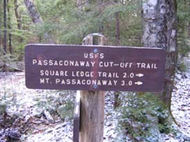
 We will start on the Oliverian Brook Trail and follow that for 1.9 miles and gain only 300 feet of elevation. Then we will take the Passaconaway Cutoff for 1.7 miles, with most of the 1,100-foot
elevation gain coming in the last mile. Then we will turn left onto the Square Ledge Trail and climb steeply to reach nice views within half a mile and again a little further on. We will return by continuing on the Square Ledge Trail to the half-mile Square Ledge Branch Trail down to the Oliverian Brook Trail. We will follow that for 3.3 miles of pretty level walking back to the parking lot.
We will start on the Oliverian Brook Trail and follow that for 1.9 miles and gain only 300 feet of elevation. Then we will take the Passaconaway Cutoff for 1.7 miles, with most of the 1,100-foot
elevation gain coming in the last mile. Then we will turn left onto the Square Ledge Trail and climb steeply to reach nice views within half a mile and again a little further on. We will return by continuing on the Square Ledge Trail to the half-mile Square Ledge Branch Trail down to the Oliverian Brook Trail. We will follow that for 3.3 miles of pretty level walking back to the parking lot.
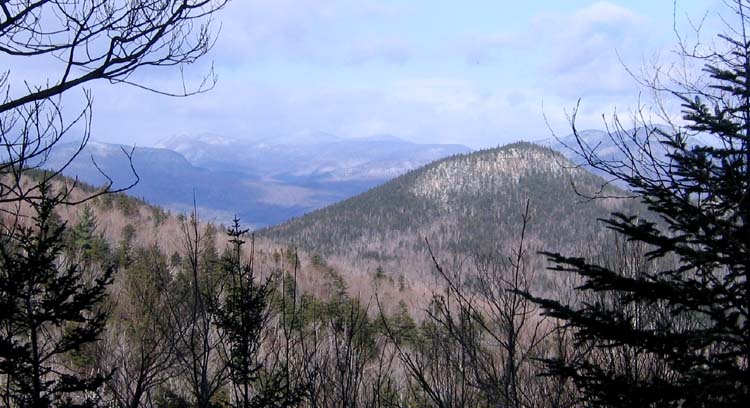
This hike is easy, except for the short stretch of steep climbing at the end, and then a short, quick descent soon after. But this really square looking ledge, when seen from Hedgehog or Potash has intrigued me. I would like to see the views from there to Mt. Passaconaway, Paugus Pass, and Mt. Paugus.
NEXT HIKE: November 17, Square Ledge
MEETING SPOTS: Mobile station in Wakefield (junction of Rt. 16 and 109) at 6:45 a.m.
Exit 14 off of Rt. 93, LL Bean/Hannaford side, Concord at 7:45 a.m.
Oliverian Brook Trailhead at 9:30 a.m
TRAILHEAD: On the south side of Kancamagus Highway, just west of Bear Notch Road.
HIKE LEADER: Faye Doria
Last week, Faye took us to Square Ledge, here is her report:
Eight hikers and one dog met at the Oliverian Brook Trailhead to go to Square Ledge. It turns out none of us had ever been there, which was surprising since four of us had completed the 4,000'ers. It was cold and windy in the parking lot, and most of us decided to add an extra layer. That turned out to be a good decision as the day stayed cold and windy.
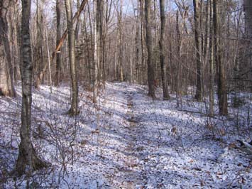
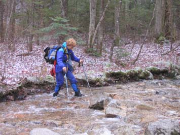
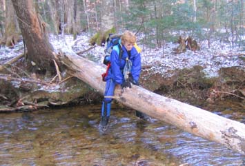
The trail was flat for quite a while, with a few uneventful brook crossings. Then we came to a wide brook with the usual crossing rocks submerged due to the recent heavy rain. But we found a wide tree fallen across the brook farther upstream and most of us scooted across that.
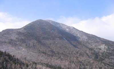
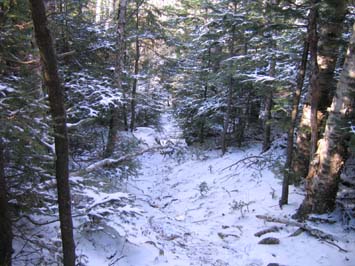
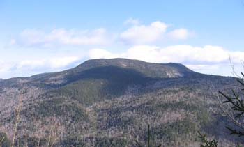 The crossings continued to be interesting, and we finally started to climb. We had some nice views through the trees to Passaconaway Mountain, and later to Mt. Paugus. The lead hikers didn't seem to
know the custom of waiting for the rest of the group at trail junctions, so we started to get spread out. Six of us had lunch on a small ledge, but the wind kept us from lingering too long.
The crossings continued to be interesting, and we finally started to climb. We had some nice views through the trees to Passaconaway Mountain, and later to Mt. Paugus. The lead hikers didn't seem to
know the custom of waiting for the rest of the group at trail junctions, so we started to get spread out. Six of us had lunch on a small ledge, but the wind kept us from lingering too long.
Then we found our seventh hiker, who had gone ahead but doubled back at the last ledge where the trail took a nearly vertical drop. We went on to that ledge and viewpoint and had the rest of our lunch.
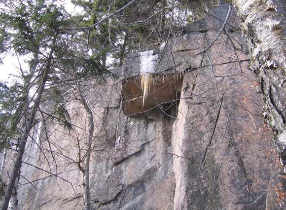
We had continuing discussion about the trail since it was quite overgrown, with lots of blowdowns to crawl under or over. And it seemed that once it started to drop, it went nearly straight down forever.
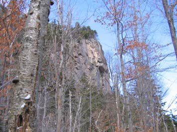
Once the trail started to level off again, we were able to look back and see why it had been so steep. It was coming down a very vertical ledge. It was a dramatic and beautiful sight. The peregrine falcons nest in the cliffs, which means the trail is usually closed from April to mid-August. That's one of the reasons it is so overgrown.
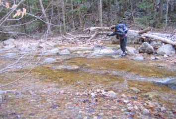
Since we had made a loop, we had different brook crossings on the way back. They seemed even worse than the ones on the way up. We used a variety of techniques - from scooting across small logs, to using partially submerged rocks, to jumping quickly through the shallows, to just wading across. No one finished with completely dry feet.
We were all happy to see the parking lot. The eighth hiker's vehicle was gone, so we assumed he had continued ahead of us. Since we were all heading different directions, we said good-bye in the parking lot. It turned out to be a nice hike to a new destination.
Members may see more photos in our online photo album.