
Castle in the Clouds, October 7, 2006
Preview
Next, Faye is taking us on the Mystery Hike, here is her preview:
The Mystery Hike on is designed to be enjoyable to anyone who has been doing some hiking
this summer. While it will be 8.5 miles long, the total climb is only 1400', and that is on easy
carriage roads. No cliffs, no steep.
The descent is down a long bare ridge with views to Lake Winnipesaukee nearly the entire way.
You'll get to hike above treeline without having to climb too high!
The route comes from an old map that was given to me by a couple we met hiking earlier this summer.
Some of these trails were recently reopened and don't appear on current maps.
I expect to have lovely views of the changing leaves, Lake Winnipesaukee, the White Mountains, and
beautiful forests. I think the hike will take about 6 hours, including lunch and breaks.
NEXT HIKE: October 7, Castle in the Clouds
MEETING SPOTS: 9:00 am at the main parking lot just east of the Castle in the Clouds entrance on
Route 171 in Moultonborogh. We won't be hiking from there, but will meet to consolidate cars.
There is only limited parking at the trailhead. The trailhead is just a few miles from that parking
spot.
HIKE LEADER: Faye
This past Saturday Faye took us on the Mystery hike, great weather and colors, here is
her review:
 Ten hikers and two dogs met at the Castle in the Clouds hiking parking lot and went up to the trailhead
parking near the bottling plant. It was cool, but crystal clear, with a deep blue sky. We took off up
the Cold Springs Trail.
Ten hikers and two dogs met at the Castle in the Clouds hiking parking lot and went up to the trailhead
parking near the bottling plant. It was cool, but crystal clear, with a deep blue sky. We took off up
the Cold Springs Trail.
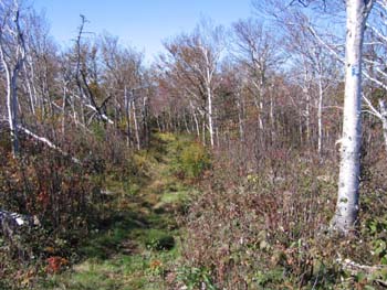
Cold Springs Trail used to lead to the Boiling Springs, but has since been rerouted. We started on a
paved road that turned off to a dirt road, and then a gentle carriage road. We climbed easily to the
junction with the Faraway Mtn. Trail. That trail climbed higher in a series of switchbacks to the High
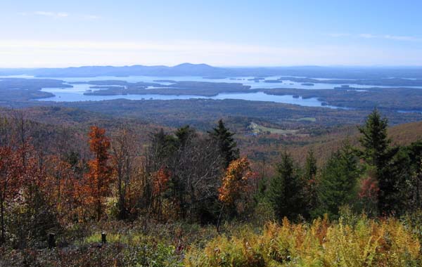
Ridge Trail. Another mile down that trail we found the first viewpoint which allowed us to look south
over the valley we had just come up, and all the way to Lake Winnipesaukee.
Since the sun was so warm and the view so great, we declared it lunchtime and sat down to enjoy the
scenery. The highlight of lunch was Jim giving away food!! He actually gave his apple core to Tessa and
Maya.
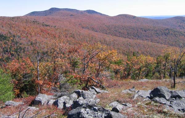
 After relaxing, we continued down the Faraway Mtn. Trail and up the side trail to the top of Faraway Mtn.
(2782'). Returning to the main trail, we went down into the col between Faraway Mtn. and Mt. Roberts
and remarked at the cool temperatures. There is a swampy area there that stays cool. We climbed to the
peak of Mt. Roberts (2582') with clear views from Mt. Chocorua, to Mt. Washington, to Mt. Moosilauke. A
signboard there helped us to identify the peaks we could see looking north.
After relaxing, we continued down the Faraway Mtn. Trail and up the side trail to the top of Faraway Mtn.
(2782'). Returning to the main trail, we went down into the col between Faraway Mtn. and Mt. Roberts
and remarked at the cool temperatures. There is a swampy area there that stays cool. We climbed to the
peak of Mt. Roberts (2582') with clear views from Mt. Chocorua, to Mt. Washington, to Mt. Moosilauke. A
signboard there helped us to identify the peaks we could see looking north.
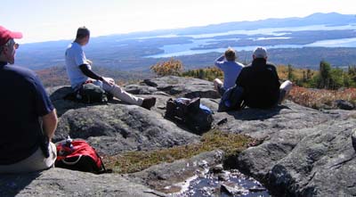
Then we headed down the Roberts Ridge Trail. When we came to the first open ledge on this trail, we all
just sat down to look south and enjoy the view. I wasn't sure anyone was getting up again. But we had
another snack and finally decided it was time to move on. We climbed down the open ridge for a while
and then finished in the woods, coming back to where we started. The total hike was about
8.5 miles.
Everyone agreed that the weather was perfect. And that the hike was interesting, especially since it was
a new trail for everyone. It was also nice to have an easier hike after the long series of strenuous
hikes we scheduled this summer.
Members may see more photos in our online photo album.